This is one of my favourite local Road Cycling routes which I ride quite regularly, although it’s relatively short it includes probably the best viewpoint in my area!.
Route Guide
As we leave Newcastle-Under-Lyme on Whitmore Road and cross the M6 motorway the route will take us on some nice quiet country lanes and through some pretty villages. After taking a sharp left turn off Whitmore Road we reach the first short climb of the ride. At the top of the incline are some nice views across Newcastle and the surrounding area.
We then head through the small, but charming village of Butterton before reaching a main road. After crossing the main road and going up a short incline, we get to enjoy a fast swooping descent through the lovely village of Acton. The gradient levels off for a few hundred yards and then comes to a short, but quite steep, fast descent. Care should be taken on the bends as traffic may occasionally be coming the other way.
At the bottom of the descent we take a very sharp left onto a quiet country lane which eventually takes us to a junction and bridge over the railway line. The road starts off relatively flat so you can get up to quite a good speed. After a sharp bend in the road to the left we hit a short, but rather steep 11% climb. The road then levels off slightly but continues to climb steadily for approximately another mile.
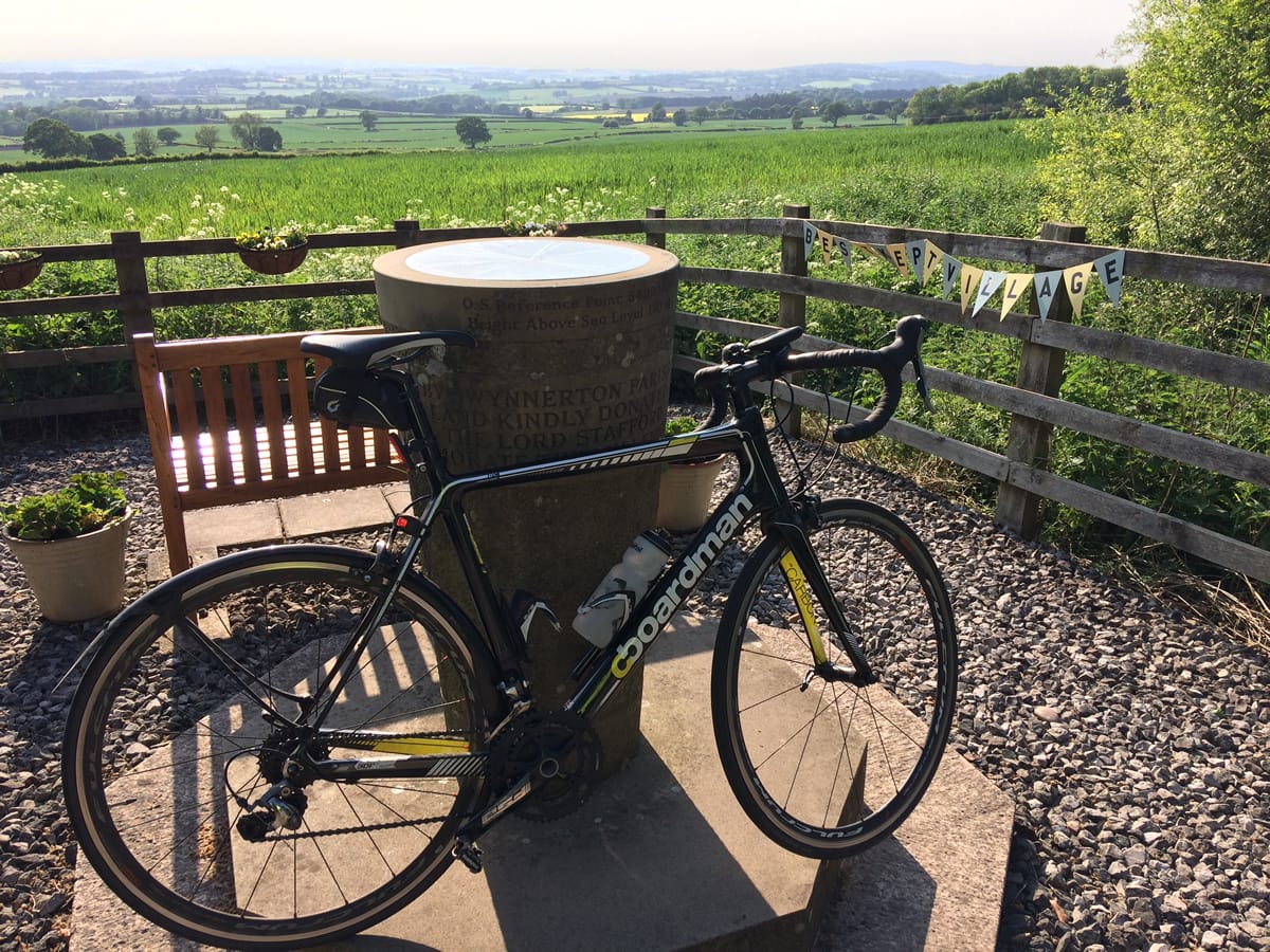
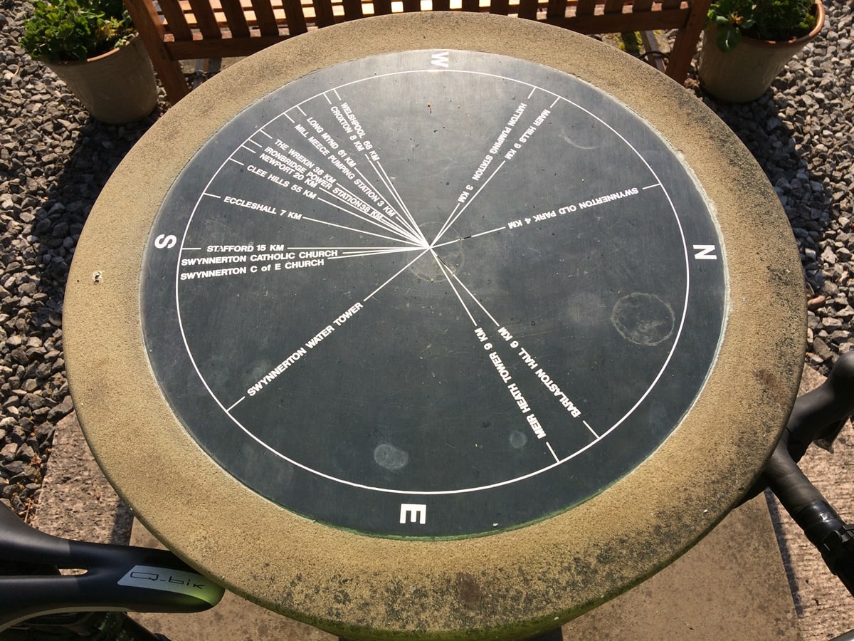
At the top of the climb we reach the excellent viewpoint at Swynnerton, which has fantastic views across the surrounding countryside and Shropshire hills in the distance. They have done a really nice job of making the viewpoint visually appealing, comfortable and interesting with a bench and a compass/sundial style map with distance markers to nearby towns of interest.
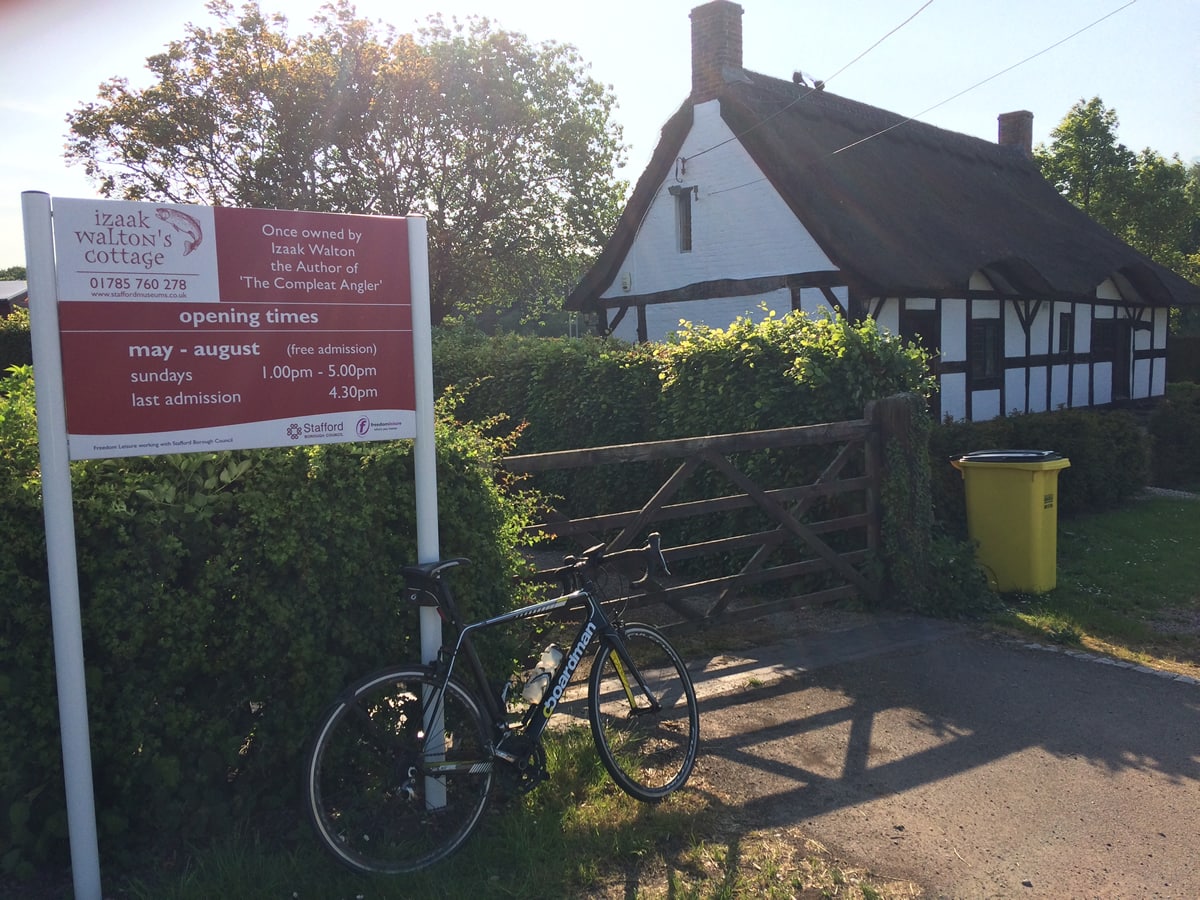
The route then takes us down an exhilarating long descent as we head towards Norton Bridge. But before reaching the village it’s worth noting that we actually cycle pass Izaak Walton’s cottage!. You may like to know it’s free to have a look around if you wish. On leaving the cottage the road meanders it’s way through the village and over a hump bridge before eventually reaching a main road junction just outside Great Bridgeford. The route continues on the main road which undulates for about 2.5 miles.

We then get to enjoy a lovely fast descent down a quiet country lane with views across the fields on both sides. After crossing a main road we continue on this country lane until reaching the A519. The start of this main road includes a short incline but upon reaching the top there is a really fast descent which sweeps through the village of Slindon. After 2 miles of virtually all descending the road goes over a bridge which makes quite a good viewpoint of the surrounding countryside and any trains running along the Railway line.
We then turn off the main road onto a quiet narrow road that runs right alongside the Railway and passes the Mill Meece Water Pumping Station. This road is for the most part quite flat so you can cruise along at a nice pace and enjoy the views of the countryside. With views of the Hatton Pumping Station on the other side we rejoin the A51 and start the loop back home.
Once reaching Whitmore road again there are actually 3 different routes back to the start. You can go back up the very steep descent that you came down near the beginning of the ride or you can go back up Whitmore road or you can go straight over the crossroads and climb up through Keele. Whitmore road is the quickest, shortest route but can be very busy at times. So I would recommend taking three mile lane and going through Keele which is quieter but also more picturesque.
If you decide to continue home on Whitmore road there is a short climb which starts off quite steep and then gradually flattens out half way up. Once over the top there is a long fast descent for a mile or so before gently climbing back up and into Newcastle.
Please note: I prefer not to show my exact home address in my routes so the Map and GPX route will begin and end as you reach the outskirts of Newcastle, you can start this route from anywhere within Newcastle.