Route Guide
The route was taken from the book – White Peak Mountain Biking: The Pure Trails (click to check current price on Amazon) Please consider purchasing the digital version of the book (Kindle device not required), as it provides zoomable Ordnance Survey maps.
There is free parking at Clough House Car Park which is well sign-posted and relatively easy to find. As you start the route and leave the Car Park there is an immediate steep road climb. After about ¼ mile the road begins to level out but then kicks up again for another few hundred metres. You then turn right onto the A54 and enjoy a fast descent for about 500 metres with great views across the surrounding countryside.
You then take a sharp left off the road onto a narrow lane which climbs up quite steeply and then splits off into two different trails. The route takes the trail on the left which is very loose and rocky. I had to walk the bike up the start of the trail, but as you reach the first bend in the track the surface becomes much more rideable.

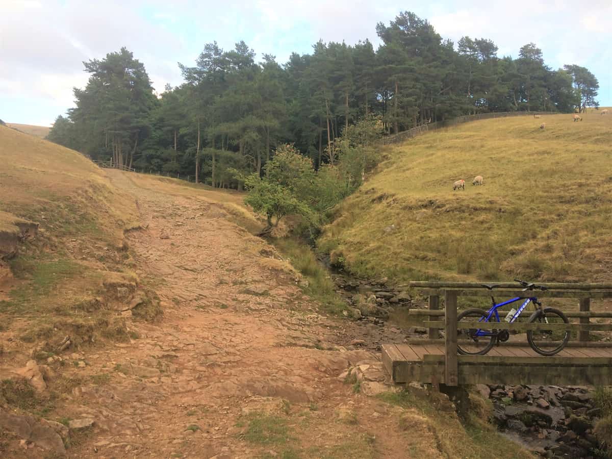
As you continue on the bridleway there is an excellent rocky descent down to a minor road. The route continues on road for about 1½ miles as you descend down the valley and take a sharp right onto Gradbach Mill Lane. You then join another bridleway and go through some woodland where the trail descends and crosses over a brook. The brook can be ridden across but watch out for the looser rocks half-way across.
The trail then climbs steeply up from the brook on a concessionery bridleway. I enjoyed this climb, it was quite rocky and challenging, but wasn’t loose and there was always a rideable line to take. As the trail exits the woodland the terrain changes to open heathland with some excellent views of the hills and valleys in the distance.You will continue on this trail for about 1½ miles following the signs for Swythamley.
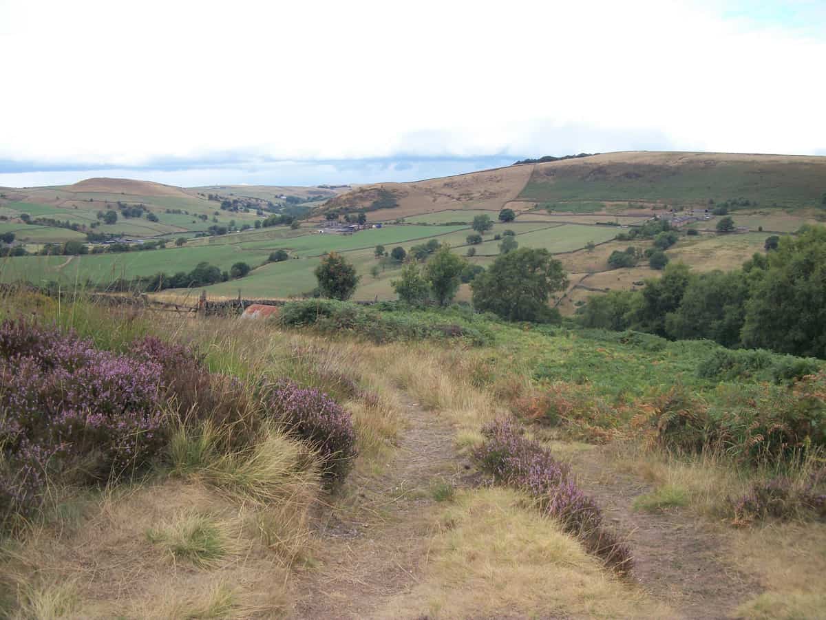

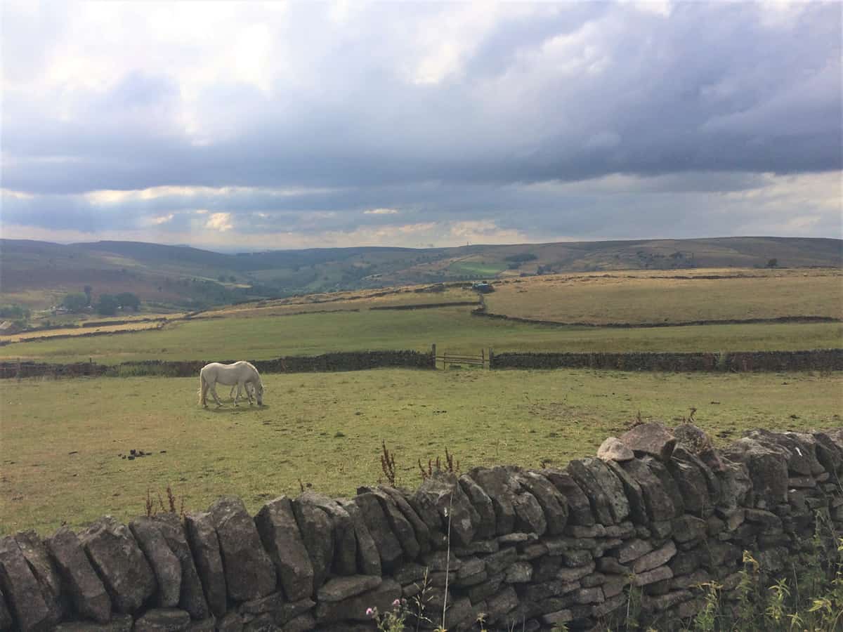
Eventually you take a left onto a minor road and enjoy a long descent before turning left again onto Hazelwood Road.The road then steadily climbs for about 1 mile and provides great views across the countryside where you can just make out the river Dane in the distance. The road then changes to an off-road track and continues to climb for a few hundred metres offering more excellent views across the valley.

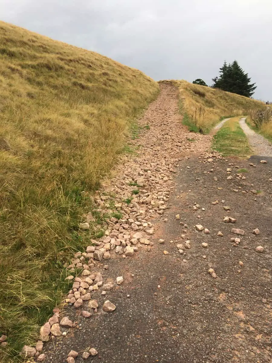
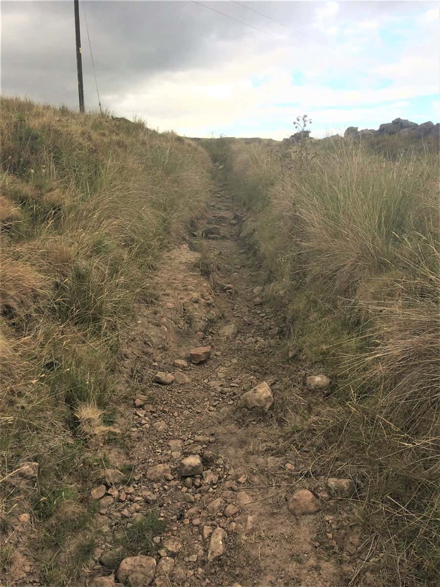
At the top of the climb you take a left onto the road then immediately left pass the ‘Welcome to the Roaches’ sign and down another bridleway. There is a nice fast descent at the beginning of the track but as it continues through the heathland it becomes more and more rocky. Due to the size of the rocks and the hidden potholes I had to walk parts of this trail.
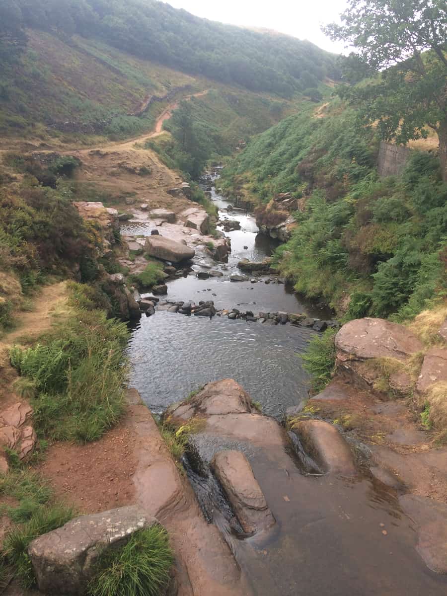
If you are comfortable riding black graded trails and rock gardens at trail centres then you may find it rideable, but I wasn’t willing to take the risk. Unfortunately the photos don’t really give a true impression of the severity of the terrain. I always appreciate water features so the stream crossing a little further on was a nice break in the trail.

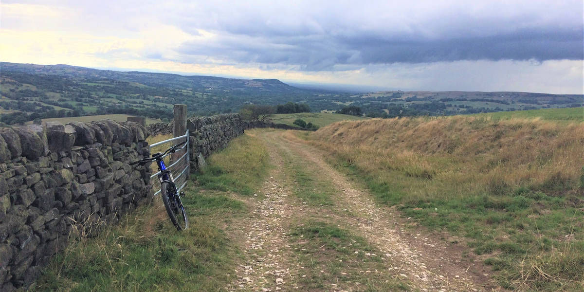
Eventually you come to a point where the bridleway splits into 3 different directions. Here you will take the left track and continue on it until you reach a quiet road. After a few hundred yards you take a left onto Goldsitch Moss Lane and continue on this for about ¾ mile. At the crossroads you turn right following the signs towards Flash.
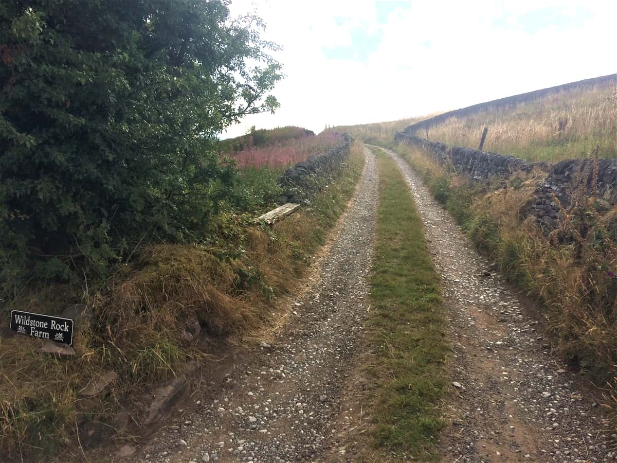
You continue on the road for about ¼ mile keeping an eye out for the bridleway on the left with a sign for Wildstone Rock Farm.The trail climbs up gradually and then descends through the farm and into the fields where you get panoramic views of the area. You go through the first gate and then take the bridleway through the field on your right. This trail is not easy to see at first but once you start riding it becomes easier to follow.
Keep following the trail until it descends down to a narrow country lane. Take a right and continue on the road for a short while before turning down the entrance for Farbrook Farm. As you descend down and through the farm you may be able to spot some Alpacas on your left in the field. You then take the bridleway on the left and descend down a very loose track and cross a stream. Again you may need to walk parts of this track.
Once you cross the stream the trail kicks up steeply so you may need to push the bike as the trail surface makes it difficult to get any traction. At the top of the climb you take a left along the narrow lane and through a farm gate. You then descend on a very loose, rocky and sandy trail down to the River Dane (may have to walk some sections).
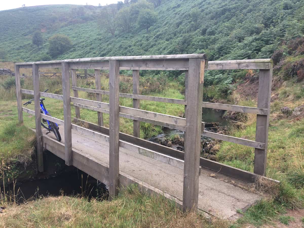
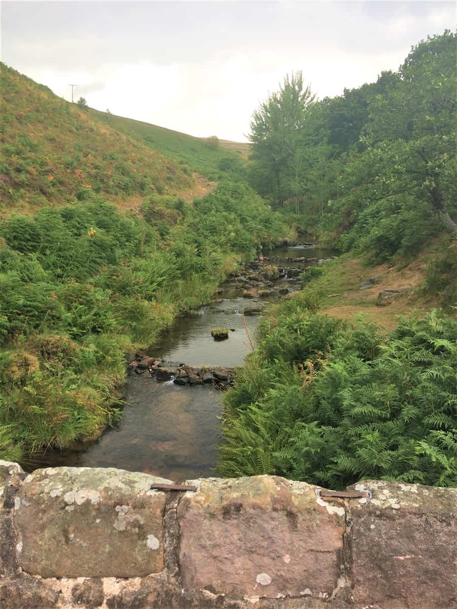
At this point I was getting quite tired and it had started raining again so I didn’t quite appreciate the fact that I’d reached Three Shires Head. This is the point where Cheshire, Derbyshire and Staffordshire meet and the bridge gives nice views of the river and hillsides around it. After crossing the bridge you take a right onto another very rocky bridleway and follow this as it climbs up and joins the A54.
You then go left and follow the road for a short while before taking the bridleway on the right. After a short incline there is a long, fast, rocky descent which follows the edge of the stream. I enjoyed the top half of this descent. However, because I was starting to tire I didn’t feel I was alert enough to ride the bottom section of the trail safely. So I either rode the higher line through the trees where possible or just walked the rockier sections. You then cross a narrow foot bridge and drop down a nice little descent back to the car park.